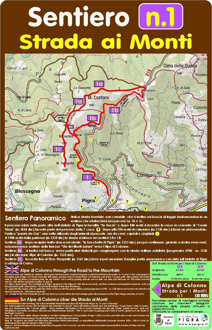
PIGRA: STRADA DEI MONTI - ALPE DI COLONNO (1,322 m)
Ancient forest road, not suitable for vehicles, which enters the beech woods, transforming into a path that will fork into routes 1a, 1b and 1c.
The route begins in the upper part of the town of Pigra in the “Su Frecia” area and after 400 meters you come across the concrete cross of “Crusia Piana” (1,020 m) which is part of the route of the 7 crosses. After another 700 meters of walking (1,150 m) there is a watering hole, the ancient "panée", once used by grazing animals, now by deer, roe deer and wild boars.
At 1900 meters from the start (1,250 m) the road bifurcates into two paths:
PATH 1a – Length: 4.9 km; Max height difference: 480 m; Duration: approximately 1.50 hours.
After a steep stretch you emerge on the ridge, the "Bocchetta di Pigra" (1,323 m), and then continue, turning right towards the North, on the panoramic path of the famous "Via dei Monti Lariani" towards the Alpe di Colonno.
PATH 1b – Length: 4.2 km; Max height difference: 400 m; Duration: approximately 1.30 hours.
It enters the woods, without any particular differences in level, to join the asphalted military road (progressive 2900 – 1,230 m) towards Alpe di Colonno (1,322 m).
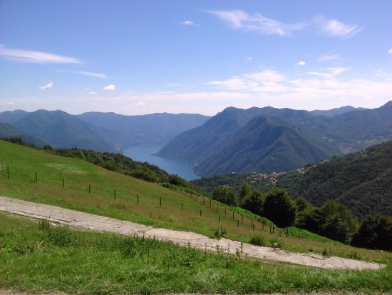
PATH 1c – On the ridge up to Pizzo Pasquella (1,367 m) where you can admire the best panoramic point overlooking the town of Pigra and Lake Como.
For more information visit the Amici Pigra Association website: http://www.aapigra.it/